|
|
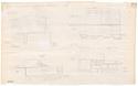
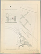
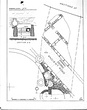
| 2nd century A. D. aqueduct: setting basin west of Panathenaic Way - Elevations ... Fragile Faint Dirty Heavy Tracing Paper Pencil ... 2nd century A. D. |
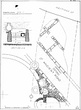
| Eleusinion - restored plan for the 6th century ... W.B. Dinsmoor, Jr. R.C. Anderson ... Based on plan by W.B. Dinsmoor, Jr. 1981. Drafting Film Drafting Ink ... 1981 |
| Transportation Unknown Packed Gravel Good ... 6th B.C. to 12th A.D. |
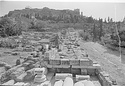
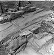
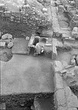
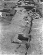
| Panathenaic Way, from north ... AMS
Photo taken for M. Miles. south Horizontal (normal) ... December 1981 |
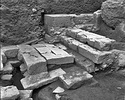
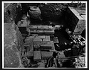
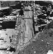
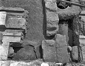
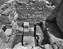
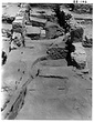
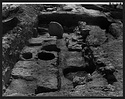
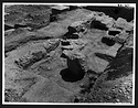
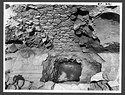
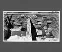
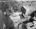
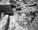
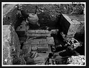
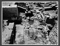
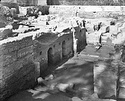
| North end of North-South Street after street Slab V was removed, revealing paving slabs of earlier street and steps leading to the Roman Agora ... AMS east 628 ... 13 Jul 1972 |
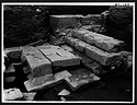
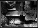
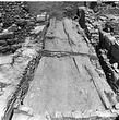
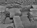
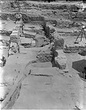
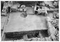
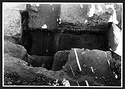
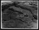
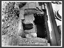
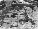
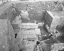
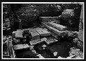
| North end of the North-South Street, after street Slab V was removed, revealing paving slabs of earlier street ... AMS north 622 Horizontal (normal) ... 14 Jul 1972 |
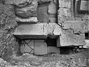
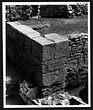
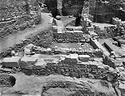
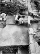
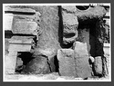
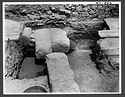
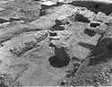
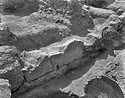
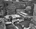
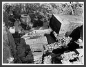
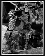
| West of Wall 5 (south retaining wall of stairway) with bucranium carved on upper course ... AMS southeast 940 ... August 1972 |
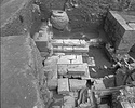
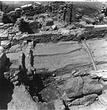
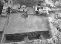
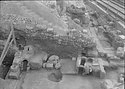
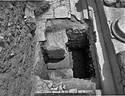
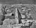
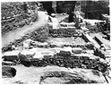
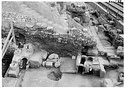
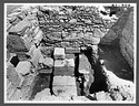
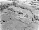
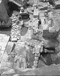
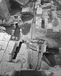
| Stepped marble ramp leading from North-South Street up to Roman Market in foreground. Top of Wall 9 (wall south of steps) in center; poros steps to market at top. View from above ... AMS south 1740 Horizontal (normal) ... August 1973 |
| North end of the North-South Street, after street Slab V was removed, revealing paving slabs of earlier street ... north 622 Horizontal (normal) ... 14 Jul 1972 |
| West of Wall 5 (south retaining wall of stairway) with bucranium carved on upper course ... southeast 940 Horizontal (normal) ... August 1972 |
| North end of North-South Street after street Slab V was removed, revealing paving slabs of earlier street and steps leading to the Roman Agora ... east 628 Horizontal (normal) ... 13 Jul 1972 |
| Stepped marble ramp leading from North-South Street up to Roman Market in foreground. Top of Wall 9 (wall south of steps) in center; poros steps to market at top. View from above ... south 1740 Horizontal (normal) ... August 1973 |
| End of season. At center, middle section of the N-S Road, delineated by the southern and middle E-W drains to the left and right, respectively ... Craig Mauzy ... cf. 2007.09.0036 west Horizontal (normal) ... 7 Aug 2007 |
| End of season. Middle E-W drain across N-S Road, with threshold block on Wall A in foreground, shown by bottom arrow, and threshold block on Wall H, shown by top arrow ... Craig Mauzy ... cf. 2007.09.0037 northwest Horizontal (normal) ... 7 Aug 2007 |
| End of season. At center, the N-S Road. Left, features east of the road, including rooms 4 (top), 5 (center), and 6 (bottom) ... Craig Mauzy ... cf. 2007.09.0070 south Horizontal (normal) ... 7 Aug 2007 |
| End of season. At center, the N-S Road, showing northern, middle and southern E-W drains. Top left, Rooms 4 (top arrow), 5 (center arrow), and 6 (bottom arrow) ... Craig Mauzy ... cf. 2007.09.0069 southeast 8954 Horizontal (normal) ... 7 Aug 2007 |
| End of season. N-S Road ... Craig Mauzy ... cf. 2007.09.0039 north Horizontal (normal) ... 7 Aug 2007 |
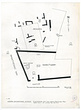
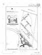
| Actual state plan of #11 Hastings Street excavation: North-South Road ... John Travlos ... 81-410 81-410 Diazotype Printing Ink
Colored Pencil
Pen ... 1958 |
| Actual state plan of #11 Hastings Street excavation: North-South Road ... John Travlos ... Shrank version 81-410 81-410 ... 1958 |
| Actual state plan of #11 Hastings Street excavation: North-South Road ... John Travlos ... 81-410 81-410 Fragile Torn Dirty Repaired Faded Heavy Tracing Paper Drafting Ink ... 1958 |
| Actual state plan of #11 Hastings Street excavation: North-South Road ... John Travlos ... 81-410 81-410 ... 1958 |
| Actual state plan of #11 Hastings Street Excavation: North-South Road ... J. Travlos ... PD 1088 Horizontal (normal) ... 1958 |
| 'Augustan road' at west end of the section, showing foundations along its south side. For the appellation 'Augustan road' cf. nb. pp. 686-692, 1289-1291, see also Hesperia 42 (1973), fig. 3, p. 370 for ... AMS east 1303 ... April 1939 |
| Augustan roadway in west end of the section. For the appellation 'Augustan road' cf. nb. pp. 686-692, 1289-1291, see also Hesperia 42 (1973), fig. 3, p. 370 for map of the same road ... AMS east 1300 ... April 1939 |
| 'Augustan road' in west end of the section. For the appellation 'Augustan road' cf. nb. pp. 686-692, 1289-1291, see also Hesperia 42 (1973), fig. 3, p. 370 for map of the same road ... AMS east 1301 ... April 1939 |
| 5th c. B.C. wheel ruts in the South Road opposite South Stoa I, Room IV ... AMS 5701 Horizontal (normal) ... 31 May 1955 |
| Wall of house bordering the south side of the South Road (east-west street), opposite the South Stoa I, Room III ... AMS south 5709 Horizontal (normal) ... 15 Jun 1955 |
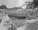
| Cut 3 through marble-paved street between Greek and Roman Agoras, showing the northwest corner of the Greek building ... AMS south 1632 Horizontal (normal) ... August 1973 |
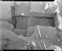
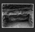
| Cut 1 through marble-paved street between Greek and Roman Agoras, showing Greek wall below ... AMS north 1684 Horizontal (normal) ... August 1973 |
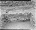
| Cut 2 through marble-paved street between Greek and Roman Agoras, showing Greek wall below ... AMS east 1646 Horizontal (normal) ... August 1973 |
| Cut 3 through marble-paved street between Greek and Roman Agoras, showing northwest corner of the Greek building ... AMS north 1648 Horizontal (normal) ... August 1973 |
| Greek remains below Room 6 of the "Street Stoa", with bedrock ledge on right; southern, early foundation wall next to it; northern, early foundation wall on left ... AMS east 2624 Horizontal (normal) ... 23 Aug 1974 |
| Greek remains below Room 6 (right) and Room G (left) of the "Street Stoa"; Roman wall in center divides Section ΡΡ from Section ΡΡ' ... AMS north 2626 Horizontal (normal) ... 23 Aug 1974 |
| General view of the north-south Byzantine street through J/9,11 (Area II) ... AMS
Grid: J/9,11 north 134 Horizontal (normal) ... 4 Jun 1981 |
| East Byzantine street wall. North-South Road in foreground. Cf. nb. pp. 2559-2567 ... AMS east 2548 Horizontal (normal) ... 1982 |
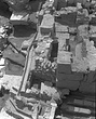
| Actual state plan of the excavations of the ancient North-South Road at no. 11 Hastings Street ... John Travlos ... PD 1088 AMS Horizontal (normal) ... 1958 |
| General view of the north-south Byzantine street through J/9,11 (Area II) ... Grid: J/9,11 north 134 Horizontal (normal) ... 4 Jun 1981 |
| East Byzantine street wall. North-South Road in foreground. Cf. nb. pp. 2559-2567 ... east 2548 Horizontal (normal) ... 1982 |
| 'Augustan road' at west end of the section, showing foundations along its south side. For the appellation 'Augustan road' cf. nb. pp. 686-692, 1289-1291, see also Hesperia 42 (1973), fig. 3, p. 370 for ... east 1303 ... April 1939 |
| Augustan roadway in west end of the section. For the appellation 'Augustan road' cf. nb. pp. 686-692, 1289-1291, see also Hesperia 42 (1973), fig. 3, p. 370 for map of the same road ... east 1300 ... April 1939 |
| 'Augustan road' in west end of the section. For the appellation 'Augustan road' cf. nb. pp. 686-692, 1289-1291, see also Hesperia 42 (1973), fig. 3, p. 370 for map of the same road ... east 1301 ... April 1939 |
| Actual state plan of the excavations of the ancient North-South Road at no. 11 Hastings Street ... John Travlos ... PD 1088 ... 1958 |
| 4th c. B.C. house wall bordering the south side of the ancient South Road (east-west street) ... southwest 4465 Horizontal (normal) ... 3 Sep 1966 |
| Wall of house bordering the south side of the South Road (east-west street), opposite the South Stoa I, Room III ... south 5709 Horizontal (normal) ... 15 Jun 1955 |
| 5th c. B.C. wheel ruts in the South Road opposite South Stoa I, Room IV ... 5701 Horizontal (normal) ... 31 May 1955 |
| Section south of the southeast corner of the Southwest Fountain House ... west 4373 Horizontal (normal) ... 26 Jul 1966 |
| Section south of the southeast corner of the Southwest Fountain House ... northeast 4375 Horizontal (normal) ... 26 Jul 1966 |
| Section south of the southeast corner of the Southwest Fountain House ... north 4377 Horizontal (normal) ... 26 Jul 1966 |
| Section south of the Southwest Fountain House. Uppermost ancient road surface ... east 4389 Horizontal (normal) ... 27 Jul 1966 |
| Cut 3 through marble-paved street between Greek and Roman Agoras, showing the northwest corner of the Greek building ... south 1632 Horizontal (normal) ... August 1973 |
| Cut 1 through marble-paved street between Greek and Roman Agoras, showing Greek wall below ... north 1684 Horizontal (normal) ... August 1973 |
| Cut 2 through marble-paved street between Greek and Roman Agoras, showing Greek wall below ... east 1646 Horizontal (normal) ... August 1973 |
| Cut 3 through marble-paved street between Greek and Roman Agoras, showing northwest corner of the Greek building ... north 1648 Horizontal (normal) ... August 1973 |
| Greek remains below Room 6 of the "Street Stoa", with bedrock ledge on right; southern, early foundation wall next to it; northern, early foundation wall on left ... east 2624 Horizontal (normal) ... 23 Aug 1974 |
| Greek remains below Room 6 (right) and Room G (left) of the "Street Stoa"; Roman wall in center divides Section ΡΡ from Section ΡΡ' ... north 2626 Horizontal (normal) ... 23 Aug 1974 |
| Section south of the southeast corner of the Southwest Fountain House ... AMS west 4373 ... 26 Jul 1966 |
| Section south of the southeast corner of the Southwest Fountain House ... AMS northeast 4375 ... 26 Jul 1966 |
| Section south of the southeast corner of the Southwest Fountain House ... AMS north 4377 ... 26 Jul 1966 |
| Section south of the Southwest Fountain House. Uppermost ancient road surface ... AMS east 4389 ... 27 Jul 1966 |
| 4th c. B.C. house wall bordering the south side of the ancient South Road (east-west street) ... AMS southwest 4465 Horizontal (normal) ... 3 Sep 1966 |
| Drains along west side of the North-South Street with cover tiles in place. Northern end of street ... AMS south 612 Horizontal (normal) ... 26 Jun 1972 |
| North end of North-South Street, with lower courses of Wall 8 still resting on steps and cover slabs on drains. Wall 5 on upper right ... AMS east 616 ... 26 Jun 1972 |
| North end of North-South Street, with cover slabs over drains, bottom stones of Wall 8 still resting on steps at left, poros Wall 5 in upper left ... AMS east 614 ... 26 Jun 1972 |
| Drains along west side of the North-South Street ... AMS south 618 ... July 1972 |
| North end of the North-South Street, after cover slabs were removed from the steps. Wall 5 at upper right. Complex of drains in foreground ... AMS east 620 ... 7 Jul 1972 |
| North end of the North-South Street, after street Slab V was removed, revealing paving slabs of earlier street ... AMS north 624 Horizontal (normal) ... 14 Jul 1972 |
| Drains along west side of the North-South Street with cover slabs removed ... AMS south 630 ... August 1972 |
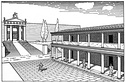
| Reconstruction of the marble-paved street and stoa of the complex east of the Stoa of Attalos, ca. A.D. 420. At left is the Gate of Athena, the entrance to the Roman Agora ... PD 2266 Cf. 1997.11.0010 Horizontal (normal) |
| North end of the North-South Street, after cover slabs were removed from the steps. Wall 5 at upper right. Complex of drains in foreground ... east 620 Horizontal (normal) ... 7 Jul 1972 |
| North end of the North-South Street, after street Slab V was removed, revealing paving slabs of earlier street ... north 624 Horizontal (normal) ... 14 Jul 1972 |
| North end of North-South Street, with lower courses of Wall 8 still resting on steps and cover slabs on drains. Wall 5 on upper right ... east 616 Horizontal (normal) ... 26 Jun 1972 |
| North end of North-South Street, with cover slabs over drains, bottom stones of Wall 8 still resting on steps at left, poros Wall 5 in upper left ... east 614 Horizontal (normal) ... 26 Jun 1972 |
| Drains along west side of the North-South Street ... south 618 Horizontal (normal) ... July 1972 |
| Drains along west side of the North-South Street with cover slabs removed ... south 630 Horizontal (normal) ... August 1972 |
| Drains along west side of the North-South Street with cover tiles in place. Northern end of street ... south 612 Horizontal (normal) ... 26 Jun 1972 |
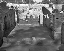
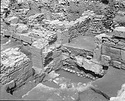
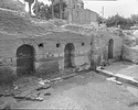
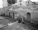
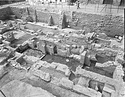
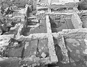
| Rooms A, B and C of the Late Roman Building in Section ΡΡ ... AMS southwest 1242 Horizontal (normal) ... 2 Aug 1972 |
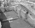
| Rooms A and B of the Late Roman Building (B in foreground) before final excavation ... AMS west 976 Horizontal (normal) ... 2 Aug 1972 |
| Byzantine wall on the east wall of Room G of the Late Roman Building ... AMS west 1318 Horizontal (normal) ... 7 Aug 1972 |
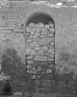
| Room A of the Late Roman Building, detail of blocked niche in the south wall ... AMS south 1388 ... 10 Aug 1972 |
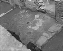
| Room 3, in the northeast corner of the Late Roman Building. Late floor with post holes ... AMS northwest 1316 ... 10 Aug 1972 |
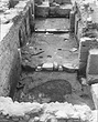
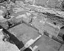
| Suite of basement rooms, early 5th century A.D. Front to back: Rooms C, B and A of the Late Roman Building ... AMS west 1382 ... 20 Aug 1972 |
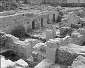
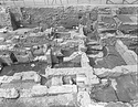
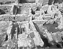
| General view of the Late Roman Building, Rooms A to E ... AMS southwest 1384 ... 20 Aug 1972 |
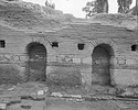
| Detail of the northwest corner of Room G of the Late Roman Building, with doorways ... AMS northwest 1340 ... 20 Aug 1972 |
| Details of the south wall of Room B ... AMS south 1380 ... 20 Aug 1972 |
| Rooms A and B of the Late Roman Building ... AMS northwest 1370 ... 20 Aug 1972 |
| Rooms A (in background), and B (in foreground) of the Late Roman Building ... AMS northwest 1372 Horizontal (normal) ... 20 Aug 1972 |
| South wall of Rooms B (in foreground) and A (in background) ... AMS southwest 1378 ... 20 Aug 1972 |
| South wall of Rooms A, B, and C (right to left) ... AMS southeast 1376 ... 20 Aug 1972 |
| General view of the rooms of the Late Roman Building: Rooms B, C, G in background, D in center and Room F in foreground ... AMS south 1386 ... 20 Aug 1972 |
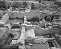
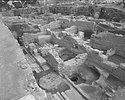
| Excavation of Section ΡΡ, end of season. General view of Rooms C to G of the Late Roman Building ... AMS southeast 1350 ... 20 Aug 1972 |
| The northwest corner ... AMS northwest 1342 ... 20 Aug 1972 |
| Central part of the Roman Building. Juncture of Sections ΡΡ (Room G) and ΡΡ' (Room 6) ... AMS north 1344 ... 20 Aug 1972 |
| View of the central area and the north corner ... AMS north 1343 ... 20 Aug 1972 |
| East end of the Roman Building (Rooms 7 and 8). Byzantine Room 1 in foreground ... AMS north 850 ... 20 Aug 1972 |
| Peristyle of the Late Roman Building ... AMS south 1668 Horizontal (normal) ... 11 Jul 1973 |
| Southeast corner of the peristyle of the Late Roman Building ... AMS south 1666 Horizontal (normal) ... 11 Jul 1973 |
| Peristyle of the Late Roman Building, view from above ... AMS north 1664 Horizontal (normal) ... 11 Jul 1973 |
| Closer view of the Peristyle ... AMS north 1670 Horizontal (normal) ... 11 Jul 1973 |
| General view of the west end of the Late Roman Building (south and central aisles) ... AMS west 1660 Horizontal (normal) ... 12 Jul 1973 |
| Detail of the Late Roman Building: upper rooms and apsidal hall (excavations and restoration completed) ... AMS northwest 1703 ... August 1973 |
|
|