|
|
| City plan as 1-104a, but including area to east and to east end of Roman Market. Dots indicate location and direction of photographs taken in 1930-1931 by Messinesi before the demolition of the houses ... (For selection from these negatives see under Houses before excavation: prints from slide negatives in Princeton) ... 1930 |
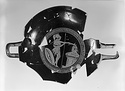
| Fragmentary red-figure kylix ... Craig Mauzy ... Raw scan in Public / Unworked / Projects / 2004.02. LCT Negatives Horizontal (normal) ... ca. 1985 |
| Red figure cup: type B and inscribed ... AMS Horizontal (normal) |
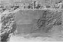
| South wall of Roman House B, Room 4, from the north ... AMS Horizontal (normal) |
| Wall C, looking south across West Trench B to blocks on North Slope ... AMS Horizontal (normal) |
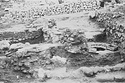
| House 648/17. Southeast corner, looking east, showing the periods of south wall. A is later period, b is earlier wall ... AMS 391 Horizontal (normal) ... 20 Mar 1939 |
| Room 7 from south. a=Top of vaulted chamber in Room 5. b=Floor 1 in Room 7. c=Floor 2 in Room 7 ... AMS Horizontal (normal) |
| South Wall (Room 3, House A) showing dark patch (pier) blocking Water Channel and Cistern Manhole. Downspout cutting at top, Cistern Channel. a=Socle. b=Drain 3. c=Cistern Channel ... AMS Horizontal (normal) |
|
|