|
|
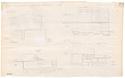
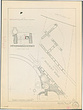
| 2nd century A. D. aqueduct: setting basin west of Panathenaic Way - Elevations ... Fragile Faint Dirty Heavy Tracing Paper Pencil ... 2nd century A. D. |
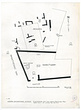
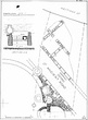
| Eleusinion - restored plan for the 6th century ... W.B. Dinsmoor, Jr. R.C. Anderson ... Based on plan by W.B. Dinsmoor, Jr. 1981. Drafting Film Drafting Ink ... 1981 |
| Transportation Unknown Packed Gravel Good ... 6th B.C. to 12th A.D. |
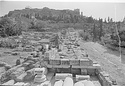
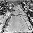
| Panathenaic Way, from north ... AMS
Photo taken for M. Miles. south Horizontal (normal) ... December 1981 |
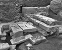
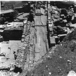
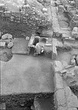
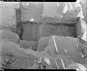
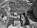
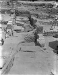
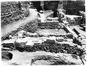
| North end of North-South Street after street Slab V was removed, revealing paving slabs of earlier street and steps leading to the Roman Agora ... AMS east 628 ... 13 Jul 1972 |
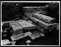
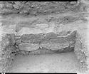
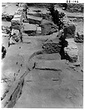
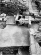
| North end of the North-South Street, after street Slab V was removed, revealing paving slabs of earlier street ... AMS north 622 Horizontal (normal) ... 14 Jul 1972 |
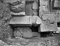
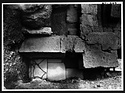
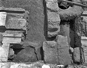
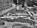
| West of Wall 5 (south retaining wall of stairway) with bucranium carved on upper course ... AMS southeast 940 ... August 1972 |
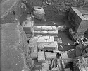
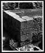
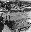
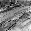
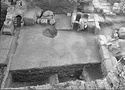
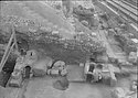
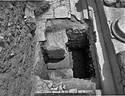
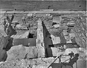
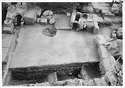
| Stepped marble ramp leading from North-South Street up to Roman Market in foreground. Top of Wall 9 (wall south of steps) in center; poros steps to market at top. View from above ... AMS south 1740 Horizontal (normal) ... August 1973 |
| North end of the North-South Street, after street Slab V was removed, revealing paving slabs of earlier street ... north 622 Horizontal (normal) ... 14 Jul 1972 |
| West of Wall 5 (south retaining wall of stairway) with bucranium carved on upper course ... southeast 940 Horizontal (normal) ... August 1972 |
| North end of North-South Street after street Slab V was removed, revealing paving slabs of earlier street and steps leading to the Roman Agora ... east 628 Horizontal (normal) ... 13 Jul 1972 |
| Stepped marble ramp leading from North-South Street up to Roman Market in foreground. Top of Wall 9 (wall south of steps) in center; poros steps to market at top. View from above ... south 1740 Horizontal (normal) ... August 1973 |
| End of season. At center, middle section of the N-S Road, delineated by the southern and middle E-W drains to the left and right, respectively ... Craig Mauzy ... cf. 2007.09.0036 west Horizontal (normal) ... 7 Aug 2007 |
| End of season. Middle E-W drain across N-S Road, with threshold block on Wall A in foreground, shown by bottom arrow, and threshold block on Wall H, shown by top arrow ... Craig Mauzy ... cf. 2007.09.0037 northwest Horizontal (normal) ... 7 Aug 2007 |
| End of season. At center, the N-S Road. Left, features east of the road, including rooms 4 (top), 5 (center), and 6 (bottom) ... Craig Mauzy ... cf. 2007.09.0070 south Horizontal (normal) ... 7 Aug 2007 |
| End of season. At center, the N-S Road, showing northern, middle and southern E-W drains. Top left, Rooms 4 (top arrow), 5 (center arrow), and 6 (bottom arrow) ... Craig Mauzy ... cf. 2007.09.0069 southeast 8954 Horizontal (normal) ... 7 Aug 2007 |
| End of season. N-S Road ... Craig Mauzy ... cf. 2007.09.0039 north Horizontal (normal) ... 7 Aug 2007 |
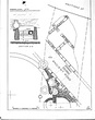
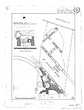
| Actual state plan of #11 Hastings Street excavation: North-South Road ... John Travlos ... 81-410 81-410 Diazotype Printing Ink
Colored Pencil
Pen ... 1958 |
| Actual state plan of #11 Hastings Street excavation: North-South Road ... John Travlos ... Shrank version 81-410 81-410 ... 1958 |
| Actual state plan of #11 Hastings Street excavation: North-South Road ... John Travlos ... 81-410 81-410 Fragile Torn Dirty Repaired Faded Heavy Tracing Paper Drafting Ink ... 1958 |
| Actual state plan of #11 Hastings Street excavation: North-South Road ... John Travlos ... 81-410 81-410 ... 1958 |
| Actual state plan of #11 Hastings Street Excavation: North-South Road ... J. Travlos ... PD 1088 Horizontal (normal) ... 1958 |
| 'Augustan road' at west end of the section, showing foundations along its south side. For the appellation 'Augustan road' cf. nb. pp. 686-692, 1289-1291, see also Hesperia 42 (1973), fig. 3, p. 370 for ... AMS east 1303 ... April 1939 |
| Augustan roadway in west end of the section. For the appellation 'Augustan road' cf. nb. pp. 686-692, 1289-1291, see also Hesperia 42 (1973), fig. 3, p. 370 for map of the same road ... AMS east 1300 ... April 1939 |
| 'Augustan road' in west end of the section. For the appellation 'Augustan road' cf. nb. pp. 686-692, 1289-1291, see also Hesperia 42 (1973), fig. 3, p. 370 for map of the same road ... AMS east 1301 ... April 1939 |
| 5th c. B.C. wheel ruts in the South Road opposite South Stoa I, Room IV ... AMS 5701 Horizontal (normal) ... 31 May 1955 |
| Wall of house bordering the south side of the South Road (east-west street), opposite the South Stoa I, Room III ... AMS south 5709 Horizontal (normal) ... 15 Jun 1955 |
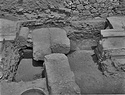
| Cut 3 through marble-paved street between Greek and Roman Agoras, showing the northwest corner of the Greek building ... AMS south 1632 Horizontal (normal) ... August 1973 |
| Cut 1 through marble-paved street between Greek and Roman Agoras, showing Greek wall below ... AMS north 1684 Horizontal (normal) ... August 1973 |
| Cut 2 through marble-paved street between Greek and Roman Agoras, showing Greek wall below ... AMS east 1646 Horizontal (normal) ... August 1973 |
| Cut 3 through marble-paved street between Greek and Roman Agoras, showing northwest corner of the Greek building ... AMS north 1648 Horizontal (normal) ... August 1973 |
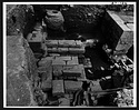
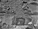
| Greek remains below Room 6 of the "Street Stoa", with bedrock ledge on right; southern, early foundation wall next to it; northern, early foundation wall on left ... AMS east 2624 Horizontal (normal) ... 23 Aug 1974 |
| Greek remains below Room 6 (right) and Room G (left) of the "Street Stoa"; Roman wall in center divides Section ΡΡ from Section ΡΡ' ... AMS north 2626 Horizontal (normal) ... 23 Aug 1974 |
| General view of the north-south Byzantine street through J/9,11 (Area II) ... AMS
Grid: J/9,11 north 134 Horizontal (normal) ... 4 Jun 1981 |
| East Byzantine street wall. North-South Road in foreground. Cf. nb. pp. 2559-2567 ... AMS east 2548 Horizontal (normal) ... 1982 |
| Actual state plan of the excavations of the ancient North-South Road at no. 11 Hastings Street ... John Travlos ... PD 1088 AMS Horizontal (normal) ... 1958 |
| General view of the north-south Byzantine street through J/9,11 (Area II) ... Grid: J/9,11 north 134 Horizontal (normal) ... 4 Jun 1981 |
| East Byzantine street wall. North-South Road in foreground. Cf. nb. pp. 2559-2567 ... east 2548 Horizontal (normal) ... 1982 |
| 'Augustan road' at west end of the section, showing foundations along its south side. For the appellation 'Augustan road' cf. nb. pp. 686-692, 1289-1291, see also Hesperia 42 (1973), fig. 3, p. 370 for ... east 1303 ... April 1939 |
| Augustan roadway in west end of the section. For the appellation 'Augustan road' cf. nb. pp. 686-692, 1289-1291, see also Hesperia 42 (1973), fig. 3, p. 370 for map of the same road ... east 1300 ... April 1939 |
|
|